October 23, 2025
Healthy forests and peatlands play a critical role in protecting biodiversity, storing carbon, and regulating water cycles. At Restorasi Ekosistem Riau (RER), restoring and safeguarding these ecosystems is central to long-term climate and conservation goals. Yet restoration is about more than just planting trees; it requires careful, ongoing monitoring of how vegetation grows, recovers, and supports the wider landscape.
Vegetation monitoring provides the evidence needed to measure progress, guide restoration strategies, and ensure that efforts deliver lasting results. As part of our ongoing forest restoration and peat monitoring efforts, RER is tracking changes in forest cover and species composition over time, to better understand the dynamics of peat swamp ecosystems and develop conservation strategies according to these insights.
In this article, we look a little deeper into this process, to reveal how vegetation monitoring works, why it matters, and how it fits into the wider forest restoration strategy at RER.
The Purpose of Vegetation Monitoring
“Vegetation is the foundation of the ecosystem. By studying it, we can understand whether our restoration efforts are truly working,” says Muhammad Iqbal, Restoration Manager at RER.
The purpose of vegetation monitoring at RER is threefold:
Without this monitoring, restoration risks becoming guesswork. With it, RER builds a long-term evidence base that informs not only local management but also broader climate and conservation strategies.
What RER Monitors and How
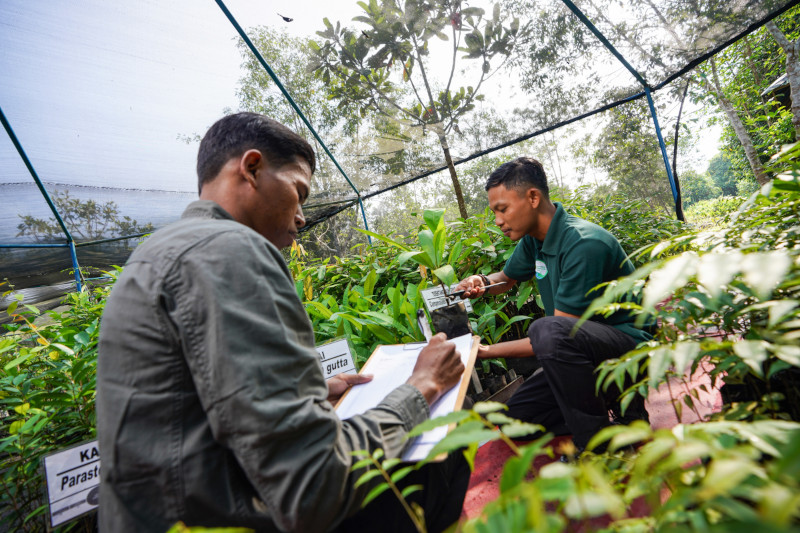
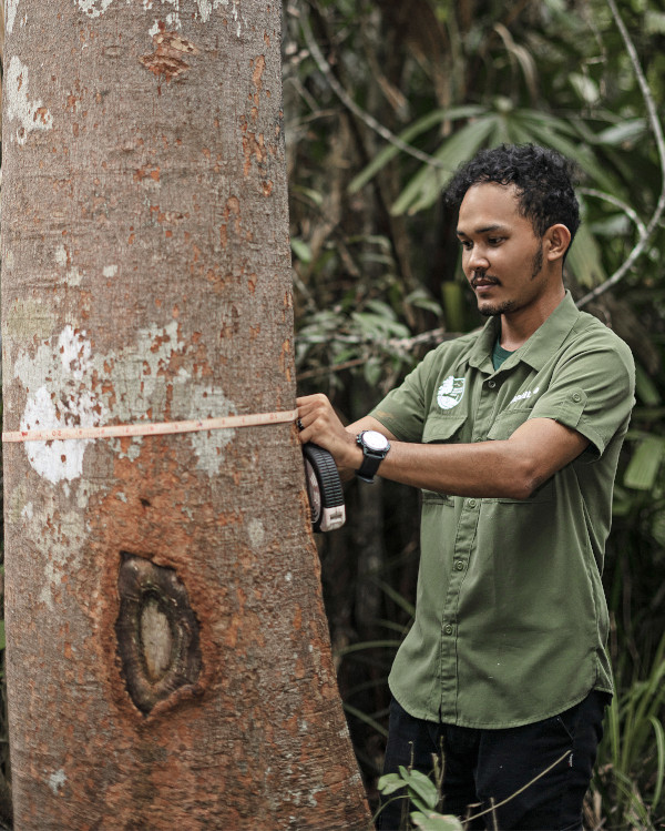
RER’s vegetation monitoring program is designed to be rigorous, consistent, and science-based. Field teams collect detailed data on forest composition and growth, which is then analyzed to track trends across the restoration area.
Key elements monitored include:
In terms of methodology, monitoring combines field surveys, permanent sample plots, and remote sensing technology. This integrated approach ensures both ground-level accuracy and large-scale perspective.
“By combining on-the-ground surveys with satellite data, we can see how local changes fit into the bigger landscape,” explains Muhammad Iqbal. “And this ultimately enables us to devise and implement strategies that are more impactful, more responsive to the unique conditions at ground level, and more likely to deliver positive results in the long term.”

Collaboration and Future Monitoring Plans
Like most activities underway at RER, vegetation monitoring is not conducted in isolation. We collaborate with local universities, international research institutions, and conservation partners to strengthen methodology and expand data use.
These partnerships offer a range of benefits:
Looking to the future, we have a number of objectives related to vegetation monitoring in Riau:
This forward-looking approach ensures RER’s restoration efforts remain evidence-driven, transparent, and scalable.
Science-Driven Restoration at Scale
Vegetation monitoring provides a solid foundation for trustworthy, data-driven restoration. By measuring how forests recover, RER ensures that conservation efforts are effective, transparent, and aligned with climate and biodiversity goals.
As more monitoring data is collected, the value of this evidence base will continue to grow. Over time, it will not only enhance forest recovery in Riau but also inform best practices for peatland and forest restoration worldwide.
To find out more about the monitoring and restoration efforts underway at RER, please explore our website.

FAQ: Vegetation Monitoring at RER
What is vegetation management? At Restorasi Ekosistem Riau (RER), vegetation management refers to the active care and control of plant communities to help ecosystems recover and remain healthy. In the context of forest and peatland restoration, it includes activities like protecting natural regeneration, removing invasive species, and supporting the growth of native trees.
What is vegetation mapping? Vegetation mapping is the process of identifying, classifying, and recording plant cover across a landscape. At RER, this involves combining satellite imagery, drone surveys, and field data to create detailed maps of tree species, canopy cover, and habitat types. These maps provide a visual record of forest condition and change, helping scientists track restoration progress, identify threats, and plan future conservation strategies.
Why is vegetation monitoring important in peat swamp forests? Peat swamp forests are fragile ecosystems. Monitoring vegetation shows whether forests are regenerating and peat soils remain protected from degradation. Combined with effective vegetation management, this ensures that restored forests in RER become resilient, biodiverse, and able to support wildlife and climate goals over the long term.
How often is vegetation data collected?
RER conducts annual surveys in permanent monitoring plots, supplemented by remote sensing throughout the year.
How does vegetation monitoring support biodiversity?
Vegetation structure and diversity directly influence the function and viability of natural ecosystems. By tracking vegetation health, RER safeguards habitats for birds, mammals, reptiles, and various invertebrate species.
What role does vegetation monitoring play in climate action?
Healthy forests sequester carbon. Through vegetation monitoring, RER ensures that restoration activities in Riau contribute to Indonesia’s emissions reduction targets and global climate goals.
Related Links