The Kampar Peninsula in Sumatra is one of the largest areas of its kind in Southeast Asia, with a rich biodiversity and high carbon stocks.
In tropical peat swamp forest, there are no natural causes of fire. Fire occurs when the forest is disturbed through logging and clearing, vegetation becomes dry enough to burn and humans either intentionally ignite a fire for land-clearing or accidentally ignite a fire through improper disposal of cooking fires or cigarettes.
RER adopts the community-based approach to fire prevention developed and successfully applied by APRIL as part of its Fire Free Village Programme. This is supported by rapid fire suppression capability, should there be an unexpected fire within the RER area.
There have been no recorded hotspots or fires inside the RER since 2015. This remarkable record is due to a combination of factors including active security postings at each of the main access points into the RER as well as daily patrols to discourage use of fire for land-clearing, the implementation of APRIL’s Fire Free Village Program in all nine communities associated with RER, NGO BIDARA’s Eco-Village program with farmer groups in Sangar sub-village to promote no-burn, intensive agriculture methods, and an agreement between RER and fishermen on the Serkap River to prohibit the use of fire in RER.

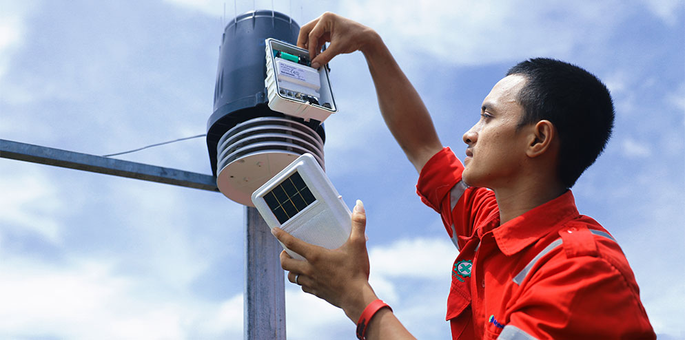
Rainfall monitoring is an important aspect of fire prevention. RER Forest Protection teams daily monitor daily weather from seven weather stations operated by RER and forestry company PT. RAPP, and their joint venture wood suppliers. On Padang Island for example, three weather stations are utilised.
Weather data from some of these stations dates back to 2002 and includes rainfall (mm), temperature (°C) and relative humidity (%). This information is used to monitor seasonal changes in the weather and compared against natural fluctuations in water table depth, as well as in calculating daily Fire Danger Ratings. ‘Since 2002, the Kampar Peninsula’s total annual rainfall averages 2,175mm, ranging from 1,514mm to 2,571mm.
The first dry season occurs from late-January to mid-March and the second from June-to-September. The wet seasons occur from October to mid-January and again in April and May. It is during these dry periods when forest vegetation may become susceptible to fire ignition, especially where cutting and clearing vegetation for gardens or plantations has occurred. Curiously, since 2008 to 2010, total annual rainfall and the 3-year average rainfall peaked and then steadily declined.
On Padang Island, since 2012 annual rainfall averages 2,271mm, ranging from 1,494mm to 2,911mm. Monthly rainfall on Padang Island ranges from less than 90mm to more than 500mm, averaging 202mm. The dry and wet season periods are similar to those on the Kampar Peninsula.

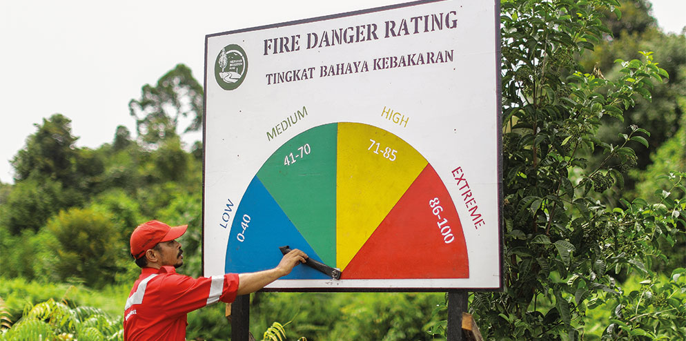
Fire Danger Ratings (FDR) estimate the likelihood of a fire to ignite and spread and whether it requires suppression action. Factors like 24-hour rainfall (mm), total rainfall in the last 15-days, number of days without rainfall and the condition of fine fuels are variables used to calculate the daily FDR. By knowing the daily FDR, forest protection teams can inform communities, fishermen and other forest users that vegetative conditions are such that there is a risk of fire. They also use this data to increase patrols and have their firefighting equipment ready for use.
Additionally, RER regularly monitors hotspot data to identify points that may be inside or close to the RER boundary. If a hotspot point is observed, the coordinates of the location are immediately transferred to field teams which check the location for any appropriate action. Hotspot data is publicly available online from the NOAA and MODIS satellites.